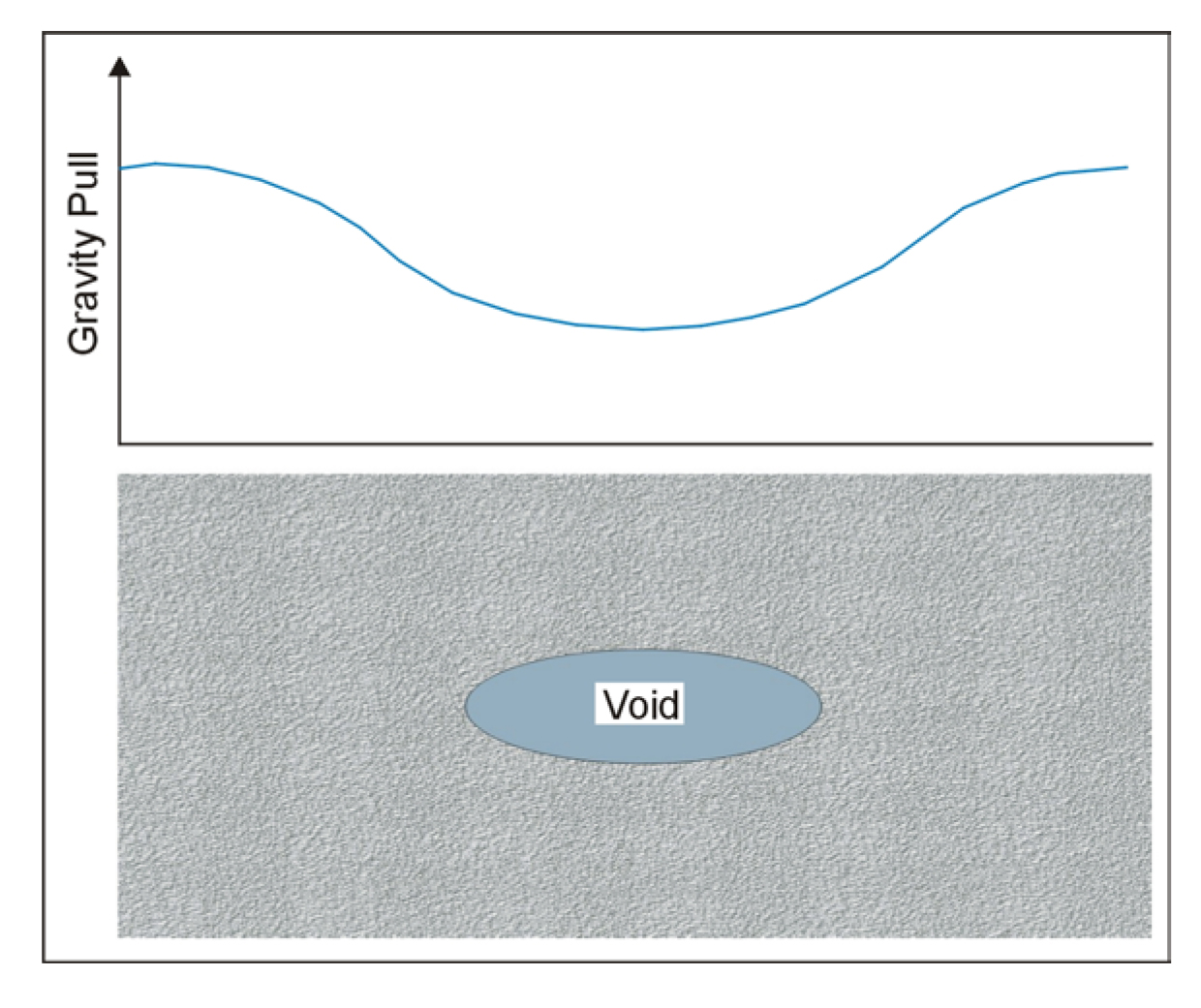
Basic Concept. The gravity method measures small spatial differences in the gravitational pull of the earth. If the gravity field over an air-filled void is measured, and the void is close enough to the ground surface, then a decrease in the gravitational pull across the void will be measured. This concept is illustrated in figure 84, which shows an underground void and the gravity profile over this void.
The instrument that is used to measure the gravity pull is called a Gravimeter. This instrument does not measure the absolute value of the pull of gravity, but measures spatial differences in the gravity pull; essentially relative gravity.
Voids can produce reasonably sized anomalies when they are large and fairly near the ground surface, but only very small anomalies result from voids at depth. Clearly, the size of an anomaly depends on the size and depth of the void, and at some point it cannot be observed. Thus, it is important to be able to measure the gravity field with as much accuracy as possible. Generally, for a spherical void to be detected, the depth to its top surface should be no greater than its diameter.

Figure 84. Gravity field over a void.
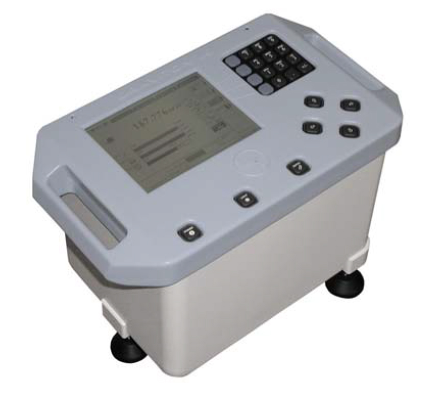
The Lacoste and Rhomberg model EG Gravity meter has an advertised repeatability of 3 microgals (980,000,000 microgals is the Earth's gravitational field) and is one of the preferred instruments for conducting gravity surveys (figure 85). Variations in gravity anomalies found when searching for cavities are typically a few tens to hundreds of microgals. These surveys are often called Microgravity surveys.

Figure 85. The Lacoste and Rhomberg model EG gravity meter. (LaCoste & Romberg)
Data Acquisition: In order to detect a void, gravity readings must be taken along traverses that cross the location of the void. Its expected size will determine the distance between readings (station spacing), with larger station separations for large voids and small separations for small voids. It is usually advisable to model the expected anomaly mathematically before conducting fieldwork. From this, along with the expected instrument accuracy, an estimate can be made of the anomaly size and the required station spacing.
Surveys are conducted by taking gravity readings at regular intervals along a traverse that crosses the expected location of the void. However, in order to take into account the expected drift of the instrument, one station (probably the first) has to be reoccupied every half hour or so (depending on the instrument drift characteristics) to obtain the natural drift of the instrument. Since gravity decreases as elevation increases, the elevation of each station has to be measured with an error of no more than about 3 cm. A more detailed description of the corrections to be applied to gravity data is described under Data Processing. Readings are taken by placing the instrument on the ground and leveling it. This may be automatic with some instruments, as it is with the Lacoste and Rhomberg model EG.
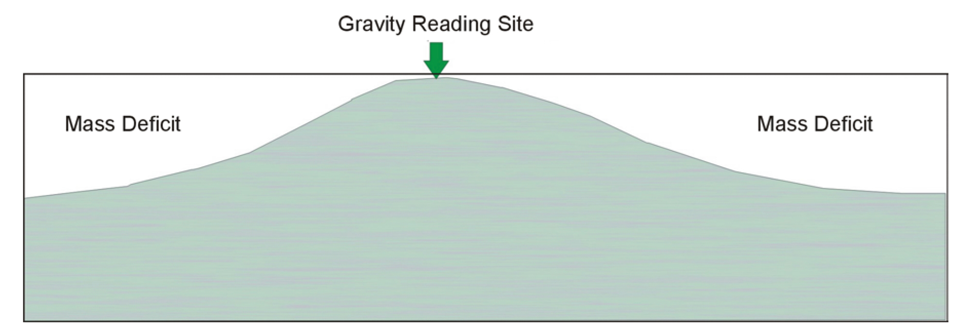
Data Processing: Several corrections have to be applied to the field gravity readings. Each reading has to be corrected for elevation, the influence of tides, latitude and, if significant local topography exists, a topographic correction. To understand the corrections, a gravity reading is first considered on the surface of a flat ground surface. Corrections are then applied to account for deviations from this condition. As the distance from the center of the earth increases, the pull of gravity decreases. The correction to account for this is called the elevation correction. If the gravity reading is taken on top of a hill, then there is a deficit of mass on either side of the hill, compared to a horizontal ground surface, as is illustrated in figure 86. This is corrected with a topographic correction. It is important to realize that mass higher than the reading site will also influence the data and has to be accounted for. This may occur in areas of significant topography or when surveys are conducted near large buildings. In a modern instrument such as the Lacoste and Rhomberg model EG, the meter may automatically apply the tidal and drift corrections.

Figure 86. Correction for topography.
Data Interpretation: Gravity data are interpreted using software to calculate the gravity field of geologic features, input by the operator. The program will then change the parameters (shape, depth) of the body (in this case void) until the calculated gravity field matches the field gravity field. This process is called inversion and is commonly used in geophysical interpretation. If several lines of data, or data from a grid, have been acquired, then a map of the gravity field may be produced.
The interpretation involves searching for areas where the pull of gravity has decreased and then modeling these anomalies to find the depth to the source of the anomaly and the approximate size of the feature.
Advantages: The gravity method responds directly to the mass deficit created by a void. The method requires a relatively small amount of instrumentation and is an unobtrusive method able to be conducted in environmentally sensitive areas.
Limitations: Gravity surveying is a labor-intensive procedure requiring significant care by the instrument observer. Gravity instruments require careful leveling before a reading is taken. This may have to be done manually or it may be performed by the instrument itself. Once the reading has been taken, the gravity sensing mechanism must be clamped to stop excessive vibration that would influence the sensing mechanism and cause excessive drift, thereby affecting future readings. The instrument must be placed on solid ground (or a specially designed plate) so that it does not move (sink into the ground). All of the stations have to be accurately surveyed for elevation.
Because the anomaly from voids rapidly becomes smaller with void depth, void detectability rapidly decreases with void depth. Because of this, pre-survey modeling using as much geologic information as possible is important to establish the expected anomaly size, and to determine if a gravity survey is feasible.
If the cavity lies in bedrock beneath a layer of overburden, variations in the topography of the bedrock surface may be reflected in the gravity profile and need to be accounted for. These variations may occur because of fracturing above the void and preferential weathering causing a bedrock depression, or they may be simply part of the normal bedrock undulations. These variations will influence the gravity data, producing anomalies that could be misinterpreted as resulting from voids. Other geophysical methods may be needed to map the bedrock topography. If, as is likely, the velocity of the bedrock is greater than that of the overburden, then seismic refraction may be used to map the bedrock topography allowing the gravitational effects of bedrock surface elevation changes to be calculated. If the overburden and bedrock have different resistivities, then resistivity soundings or conductivity measurements can also be used to map the bedrock surface.